
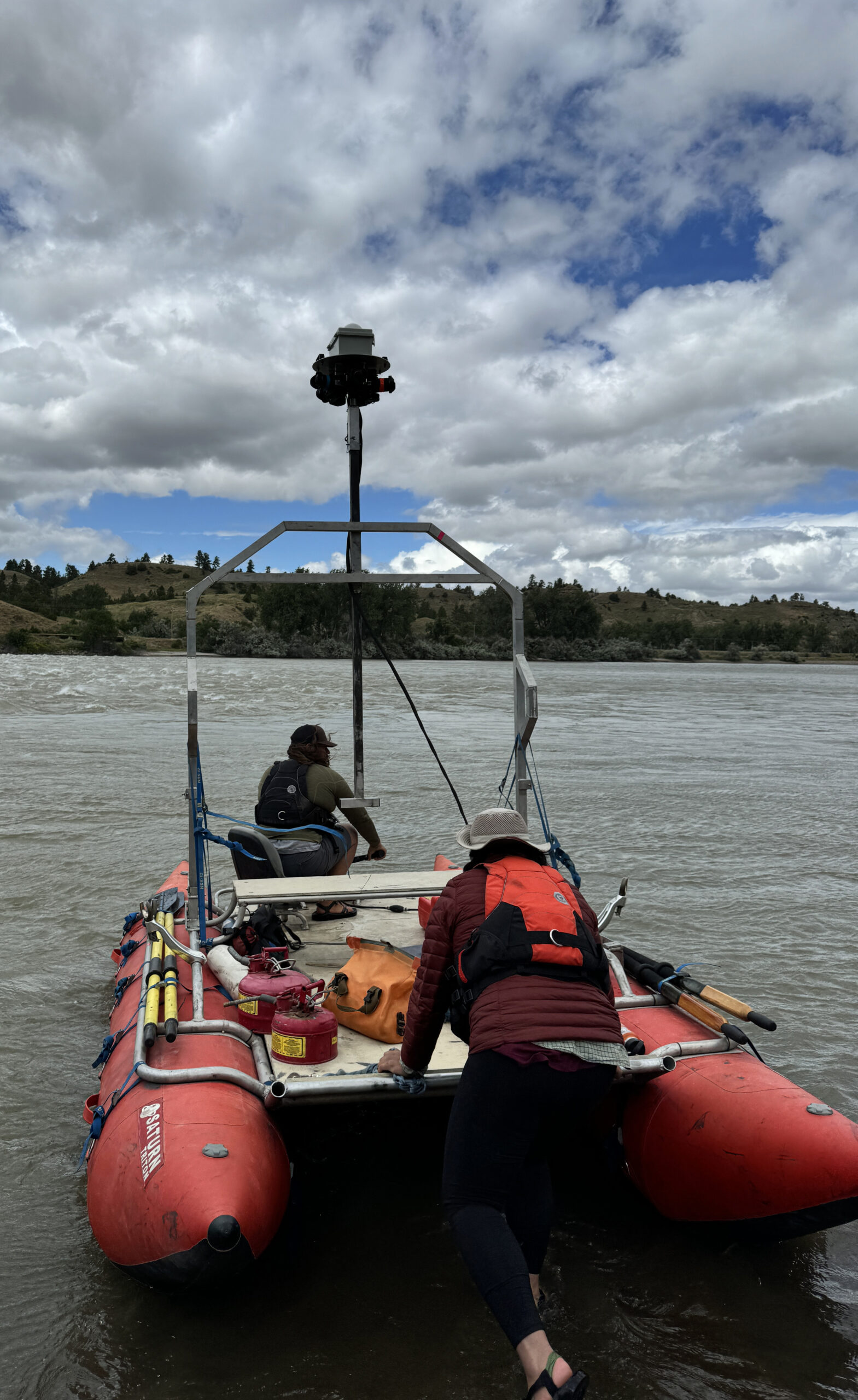
The Lewis & Clark National Historic Trail travels 4,900 miles across 16 states, including Montana. A Virginia company, Terrain360, is working to cover the entire route with a 360-degree camera, like the one used by Google Street View. This summer, the company floated a section of the Yellowstone River from Livingston to the confluence of the Missouri River to retrace William Clark’s route on the return trip across the country. Prior to this year, Terrain360 had covered about 1,700 miles of the route, including some overland sections like the Lolo Trail and Lemhi Pass, as well as sections of the Missouri River Breaks and the Blackfoot River. Eventually, anyone with a computer can travel the entire route from the comfort of their home, or plan trips based on what they see from the video tour. To learn more about the project and the trail, check out my story athttps://billingsgazette.com/
Brett French reports: A 360-degree view of the Lewis & Clark trail
The Lewis & Clark National Historic Trail travels 4,900 miles across 16 states, including Montana. A Virginia company, Terrain360, is working to cover the entire route with a 360-degree camera, like the one used by Google Street View. This summer, the company floated a section of the Yellowstone River from Livingston to the confluence of…

Related Coverage
More Stories Like This
-

Optimal Fishing Strategies for Yellowstone Rivers in mid-June by YCFF
Yellowstone Country Fly Fishing reports that cold weather in April and May has improved local fishing conditions heading…
-

When the Law is the Least of Your Problems
We’ve all had bad days, but we’ve probably never had a “fleeing the cops on three tires, leaping…
-

Experience Montana’s Free Fishing Days This Father’s Day
Montana offers a unique gift idea for Mother's Day and Father's Day: a free weekend of fishing without…